Get ready to hop in and experience storm chasing for yourself!
“When you used to tell me that you chase tornadoes, deep down I thought it was just a metaphor”- Melissa from the movie Twister.
It’s not a metaphor, it’s a reality for the Prairie Storm Chasers. Made up of three Alberta chasers, we document and report severe weather across tornado alley and Canada . We have been described as crazy, insane, dangerous, and adrenaline junkies. Now, get ready to hop in with us and experience storm chasing for yourself.
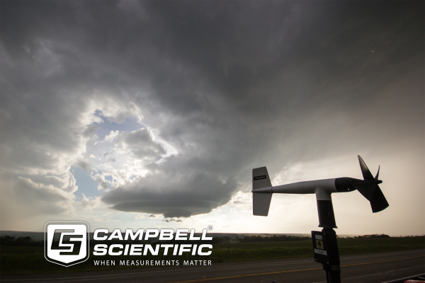
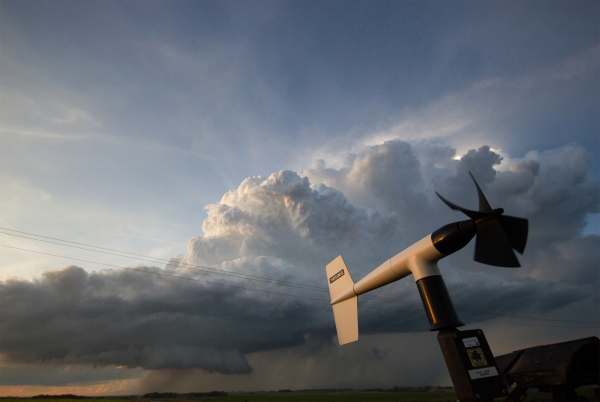
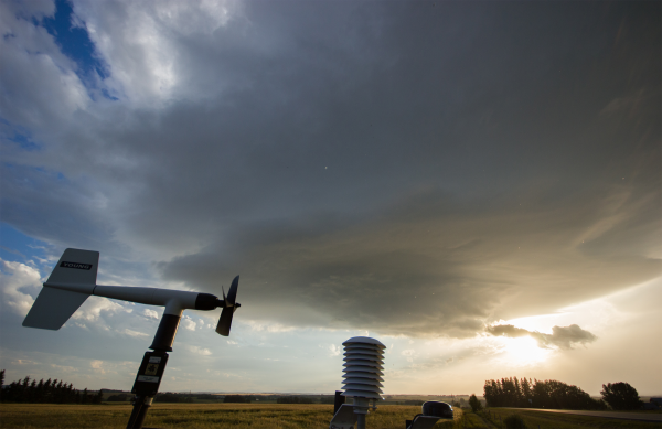
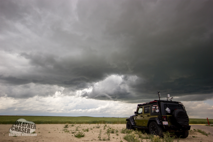
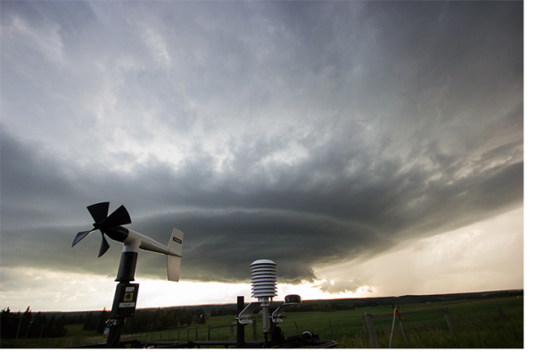
The day begins with a morning debrief. We have been watching the trend for ideal storm conditions for a few days and one more run of the models and latest visible satellite helps us chose our target under crisp blue skies. Now that we have arrived at our target for today, we wait. Southeasterly winds and increasing dewpoints are a welcome sign. We are able to check the conditions live through our Campbell Scientific custom station and datalogger. It includes an RM Young anemometer, temperature/dewpoint measurements, and a GPS. Our datalogger, mounted inside the armored Jeep, seamlessly transmits the data to an iPad mounted in the front. Campbell designed and installed the system to help us in the hours before storms initiate and for reviewing data post-chase. Wind direction at the surface and dew point are significant players in tornadogenesis- the development of tornadoes. It helps us prepare for what we might expect in the next few hours.
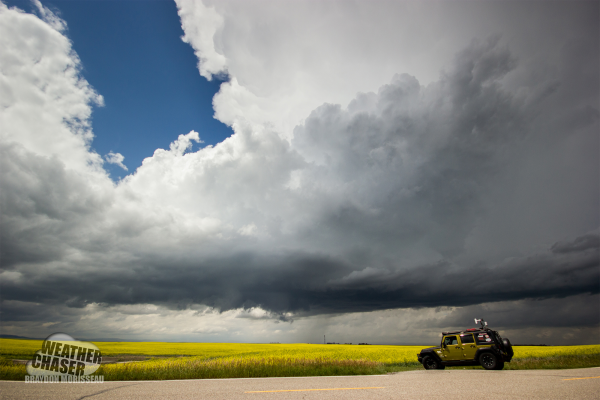
The blue sky is now spotted with towering white cumulus clouds as the daytime sun heats up the warm, moist air we measured earlier. One tower rises higher than any other and the chase is on!
Positioning ourselves just southeast of the rapidly growing supercell, we have our cameras rolling. Our livestream shows the officials at Environment Canada what the storm is doing in real-time. Radar takes time to scan, so the only truly valuable and LIVE data is what they see through us.
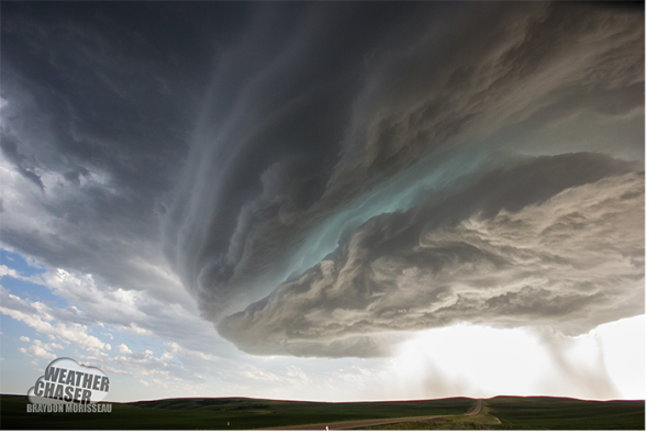
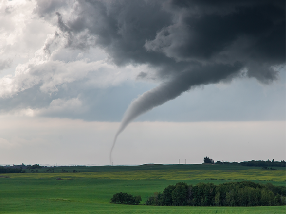
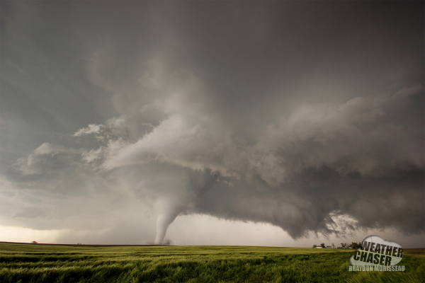
Suddenly the winds from the southeast increase rapidly. Warm, moist air is flowing right into the storm. This is it! We can tell. We quickly report the change in conditions from our station to Environment Canada. It’s changing so fast, the storm must be ingesting an outflow boundary. The supercell now has a protruding cloud from the base of the spinning updraft - a wall cloud. This is the precursor to a funnel or tornado. We reposition and the storm dances, whirling and twirling a funnel from the wall cloud. We phone Environment Canada to report a funnel and that a tornado is imminent. Warnings sound instantaneously over the radio “TORNADO WARNING-WATER VALLEY, Alberta”. The six hour drive to get here, the hours of model analysis - for this moment. The science, the pursuit, and the feeling when it all comes together are hard to put into words. Only 10-15% of supercells are capable of producing a tornado - this one did. We were in the right spot today. Hopefully we made a difference in getting those warnings out.
This summer Alberta confirmed 13 tornadoes. The Prairie Storm Chasers were integral in triggering many of the tornado and severe storm warnings. It’s not about just driving towards clouds or chasing radar. We are fortunate to have such amazing networks and tools to ensure we get to the right place, at the right time.