07-01-2016
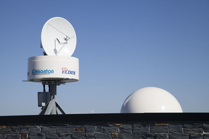
In September 2015, The City of Edmonton installed a mini-weather radar system on the Campbell Scientific Canada roof. Our building happens to have the appropriate height and visual range required for the system so we were more than happy to help out with the project. Below is an article written by The City of Edmonton on the topic.
by Daniel Jobin & Christian Jacques, Kije Sipi Ltd - RadHyPS Inc Steven Chan, City of Edmonton
On September 24, 2015, the City of Edmonton became the first municipality in Canada and perhaps in North America to acquire its own mini-weather radar for storm water management.
The X-Band system (see photograph below) was supplied and installed by RadHyPS Inc. and is remotely operated for the city under a multi-year agreement. Maintenance is being carried out with assistance from Campbell Scientific Inc. in Edmonton.
Although the system has a maximum range of 108 km, it will likely be operated at 22 or 36 km in order to obtain a higher range resolution of better than 150 m; hence, sample size.
The system is being commissioned and tested over several months to ensure readiness for the spring of 2016. This includes determining an optimal set of operating parameters such as input data for the statistical clutter filter. Different antenna elevation angle combinations are also being evaluated in order to develop the optimal scanning strategy using the shortest update cycle to generate various products such as Plan Position Indicator (PPI) and Constant Altitude Plan Position Indicator (CAPPI) data.
The following figure shows a PPI product acquired on October 20th. The PPI is for a 2 degree vertical elevation and a maximum range of 36 km with clutter filtering enabled. The azimuthal resolution was set at 1 degree oversampling with a 150 m range resolution. The radar reflectivity data shows a storm front moving from the west toward the City of Edmonton which is located near the center of the image.
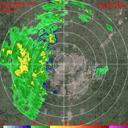
Plan Position Indicator 2015-10-20
The anticipated high spatial and temporal resolution data will help the city to further its urban water resources research and development that was presented in previous CMOS Bulletins (Vol.41 No. 2, 3, 4 & 5). A key objective of the system is to provide the city with improved gauge-adjusted radar rainfall data for utmost rainfall storm characterization.